Showing posts with label route. Show all posts

Saturday, December 25, 2010

Trail Sg Kandis > Shah Alam > Klang

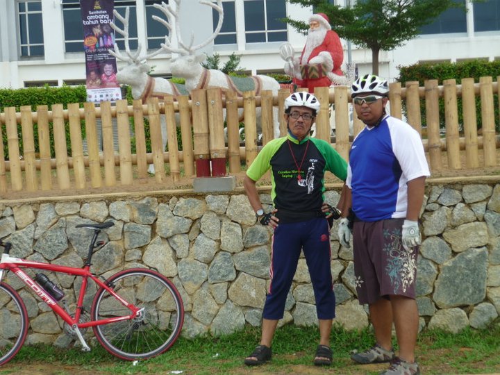
It is Christmas today ..

Usual Suspects - Bro Wahid, Wak Ros, Mas Cocok and me

Peaceful day to ride - Dataran Shah Alam

i-City Home of Christmas and New Year Celebration

It is Christmas in December not June


Self portrait at Ambeng Point

It's never been enough with these guys

On the flyover Off Lorong Azmi

End of route. Enjoy ride, be safe.

Saturday, January 9, 2010

Trail Kota Raja > Taman Rakyat Klang


View Taman Rakyat Klang in a larger map

Distance 8.43km


This trail considered easy ride and could be completed with in half an hour. Good additional trail for Sunday Kota Raja Ultimate Trail that aim to be 30km one way round.


Enjoy ride, be safe.

Wednesday, January 6, 2010

Trail Kota Raja > Pengkalan Batu


View Trail Kota Raja > Pengkalan Batu in a larger map

Distance 13.3km


Tired of being chased by monkeys of Bukit Jati every time cycling up the hill, I've change last evening trail headed to the town. The destination, Taman Pengkalan Batu.  The park located beside the Sungai Klang and about 5.3 acre along the river. This park was equipped with fishing deck, gazebo, walking path, playground and a square for recreational. 


As usual I'll use Lorong Azmi as a warming up runway till main road Jalan Kota Raja and turn right to the town. Then turn left at Jalan Dato Hamzah passing Sekolah Kebangsaan Klang, TM and Pejabat Agama and turn into Jalan Stesen till t-junction. The junction is exactly in front of KTM Kommuter Klang which right will take you back to Jalan Kota Raja and left will lead you to Jalan Tengku Kelana (Jambatan Tengku Kelana). Take left.


On Jambatan Tengku Kelana there is an exit point for pedestrian and cyclist to get down to the Taman Pengkalan Batu. As first timer I wonder what would KTM workshop look like. I took a short tour into the area and turn back to the Taman Pengkalan Batu.  At the park, follow the path along the river till the end. It will take you pass the fishing decks and gazebos. You can continue with Jalan Lembaga Bandaran but I choose to return back to the square. 


There is a historical monument in that area. 1961 Jambatan Kota Klang, the double decked bridge. The bridge was used between 1960's to 1990's. Currently still being used by pedestrian and cyclist as a short cut that link Klang Utara and Klang Selatan. Make the historical cross and come back to the park. Next destination ?

While all the ride to the park only took 20 minutes, I've decided to add another spot in this trail. Which is Taman Diraja Klang located next to Istana Alam Shah and Little India of Klang. This ride took a mild climbing, the road is kindof  narrow. So, ride on pedestrian path along Jalan Istana. The road will pass the Royal Klang Club, lead you till the palace and one round to the top of the hill. The whole hill is the royal park. Get down from the hill and take left into Jalan Limau , another left into Jalan Raja Jumaat until reaching Jalan Kota Raja. 


At the Jalan Kota Raja, take left to the town and turn right into Lorong Azmi to get back to Jalan Demang 6. It took about an hour for easy ride to complete. End of route.

Next trail. Have you ever been to Taman Rakyat Klang, Andalas ?

Saturday, December 26, 2009

Trail Pulau Jerejak


View Trail Pulau Jerejak in a larger map

Distance 3.85km


Pulau Jerejak .. I wont say much about this island .. It was prepared historically with two trails here .. the beach trail and the hill trail ..


The beach trail is about 2km, ride with couples easy climbing. Started at Jerejak Resort & Spa Outdoor Center, ride up to the north and you will pass abandoned quarters area that called KEM 4. Nothing much left here, but i could identified the main hall ruin. Surau, kindergarten, and few houses was left untouched. Along the way the trail is Waikiki beach, soccer field, abandoned shooting range, and old cemeteries.


The trail, beach on the left-side while old cemeteries on the right-side.


At the end of the cemetery was called Kebun Pak Dali mark by big tree beside the beach. There was a big hill to climb to cross, but now it seem not like a hill anymore .. Continue ahead till the jetty, it was abandoned and rusty. The jetty was the main entrance to the island during Alcatraz time. Follow along the beach till the tip of the island where the abandoned barrack located on top of the hill. End of route. Ride back to the resort.


The abandoned jetty.


The second route is hill trail. It will lead to the dockyard at the east coast of the island and around 1km only. The trail is one climb to the peak and ride down till you reach the dockyard. Hence the dockyard is restricted area, turn back to resort via the same trail. The ride is cool with the trees roofing along the trail. End of route.


The resort has prepared the rental bikes, but don't expect much.


The rental bikes. Softtail dan hardtail available. RM10/hour


It is good for the resort business if they allowed visitor (especially the bikers) to bring their own bike. Because this should be among the favorite tropical trails that northern region have.


Enjoy ride. Be safe.

Thursday, December 24, 2009

Trail Taman Melati > Klang Gate > Taman Melawati


View Larger Map

Distance 12.1km 


Not an early morning ride but not so late though.  Reached Taman Melati's Esso Petrol Station around 0830hrs. Met up with Sydin at 0900hrs. Before start cycling, Sydin has briefed shortly about the route and it surrounding area. Then we move to Taman Melati's Petronas to pump in the bicycle tyres and made some fine adjustment on the bikes.


Then we move slowly toward Bukit Tabur via Jalan Kolam Air. The ride are smooth with easy climbing until the Klang Gate Dam at the end of the road. We have passes few big houses and orchard along the way up. After that we have turn back into Jalan H1, to Jalan Melawati 4 and roll down Jalan Taman Melawati. We took a break by having a brunch (breakfast + lunch) at Lorong Bandar. The nasi lemak is not bad with lot of lauk to choose. I add on a bergedil and rendang kerang, while Sydin just having nasi lemak telur goreng. 


The break took only about 15 minutes, we continued the journey back to Taman Melati. This time we used to follow Jalan Bandar and engaged into Kampung Klang Gate Baru. Cross over the MRR2 and reached Taman Melati's Esso Petrol Station at 1100hrs. End of route. This was a warm up ride without a warm up. Well now i knew how it feels like. Uhh!!


Enjoy the ride and be safe. Don't mind if we join you at your favorite route ?!! Keep in touch.


Saturday, December 19, 2009

Trail Penjara Jelebu > Kampung Chennah


Distance - 26.9km 


The route start at Penjara Jelebu Quarters Area headed south along Jalan Genting Peras N32. Turn left after Dewan Orang Ramai to Jalan Kampung Temelang N25. There is an easy climb, and stop at the peak of the hill. We are about to enter the rubber estate area. From this point there will be a downhill across Kampung Temelang, Kampung Kenan untill Kampung Poum. Ride along the Sungai Kenaboi on our side to Kampung Chennah.


Sungai Kenaboi is a well-known spot for water activity like kayak, rafting and white rafting.  The kayak and rafting route start from Sungai Kenaboi and end up at Sungai Pertang thru down stream. While the white rafting are held up stream from Sungai Kongkoi. Along the Sungai Kenaboi there are few settlements; Kampung Kekabu, Kampung Siamat, and Kampung Telekong before reaching Kampung Chennah.


Then come the climbing part. Start from Kampung Chennah up to Kampung Chua Lebu and to Kampung Kongkoi. The climbing is a combination of moderate to high along the way up. The jungle area would be on the left-side while the white river on the right-side. This route is cool, the insect are singing with high pitch and river are humming and rumming (please mind this word) while we are struggling ride up to conquer the peak. We will cross the Kampung Esok, which is the entrance to the famous Lata Kijang. (that will cover later)


Reaching Kampung Kongkoi is heaven. We are not at the top of the world. But from now on,  the route are flat and unhurt to Kampung Gelimau. The payback time is now, we are all long way down to the finish line. All the sweats climbing up the hill pay off when you let the wind slap your face, punch your body, bite your hands and legs. Not a single round of cycle need to reach the end point, Penjara Jelebu back then. End of route.


Beware, you are about to enter a remote site. Study the map, terrain and satellite view. While the Kampung Chennah facilitate with Police Station and Medical Center, the nearest town is Titi, 3.4km and Kuala Klawang  located Off N32, 14.3km from the starting point, Penjara Jelebu. Make sure you are ready with back up and support. Enjoy the ride and be safe.


Do you dare to ride ?!!

Friday, December 18, 2009